Starting from St Agnes Head car park, just head towards the coast path from the car park
Join the South West Coast Path and head southwest, keeping the sea on your right.
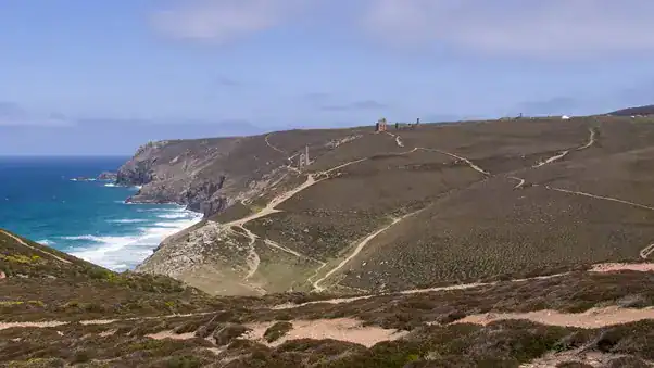
The path will take you past the iconic Towanroath Shaft and other engine houses of the Wheal Coates mine. Just past the disused mine shaft, look out for Tubby’s Head – a promontory, with the barely visible remains of what is thought to be an Iron Age cliff castle. Don’t be tempted to try to access the promontory – it’s steep, the land is rough and it’s all too easy to slip
Continue following the path as it descends into the valley, bringing you down to Chapel Porth beach. This is a great spot to pause and enjoy the spectacular sea views.
From the beach, head to the Chapel Porth National Trust car park (toilets and café available here – why not treat yourself to an ice cream?!) . From here, take the road to the left of the buildings in the car park, leading inland and beginning to climb towards St Agnes Beacon. The road follows the base of the crevace, between two rocky banks. Note that you should be on the road, on the left side of the stream, not the right side – this is the SW Coast Path, which will take you in the wrong direction.
After just under ¼ mile, the road turns to the left in front of a pair of houses – keep following the road around to the left.
Keep along the road, past the camp site and after about another ¼ mile you’ll come to a T junction. Turn right – the road goes straight ahead, and becomes Goonvrea Road.
At the Beacon Country House Hotel, a road and a track turn off to the left – but you should stay on the road to the right.
Shortly after, you’ll come to a crossroads – turn left here, taking the road signed to “Higher Bal” – this is Beacon Road, and takes you uphill toward St Agnes Beacon.
Keep walking along Beacon Road, until you come to Greenacres Farm – then after another 100 metres or so, look for a gravel pathway off to the left. This path takes you toward St Agnes Beacon.
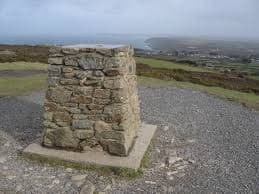
As you climb toward the summit of the beacon the path takes a turn to the left (it’s almost a T junction – don’t take the path to the right) and climbs steeply – head to the top of the beacon for panoramic views in all directions. The trig point marks the highest elevation.
Once you’ve had your fill of the view, continue along the path in the same direction as you were heading before, facing the sea, and toward the St Agnes Beacon Trail car park, heading downhill steeply.
Where the path meets the road again, take the small lane opposite, going past a wooden building in the corning of the field on your right.
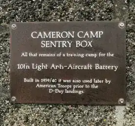
Shortly after this, and next to a brick shelter (actually a sentry box from World War II, and now all that remains from a training camp used by American Troops ahead of the D-Day landings) take the path off to the left. This path will skirt around the edge of a disused quarry, descending more slowly as you head back to toward the sea
As you reach the cost, this path joins the main SW coastal path. Turn right here to return to the car park where you started.